
E-Flora MAPPING
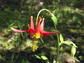
Aquilegia formosa (Sitka columbine
) photo by Kent Brothers
| Introduction | Sample Maps | Links to other Maps | References |
As an atlas of the plants of British Columbia, E-Flora BC revolves around maps and GIS. Using plant specimen data from key data providers including the UBC Herbarium, the Royal BC Museum, the National Herbarium of Canada and the Biogeoclimatic Ecosystem Classification database, we have developed both comprehensive static maps and dynamic interactive distribution maps for BC plants. Formatting and display of the maps continues to be programmed, and new data will allow us to map non-vascular plant distributions in addition to vascular plants.
Eventually,
a search conducted in E-Flora will provide not only distribution
maps for a species, but also clickable overlay maps of the
province's climate, precipitation, topography, snow cover,
biogeoclimatic zones, etc., all with zoom capability. The
ability to overlay maps will make E-Flora BC an important
information and research tool for those investigating our
provincial flora. Development of the overlay mapping
is underway.
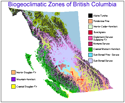
Source: BECWeb
(http://www.for.gov.bc.ca/hre/becweb/papermap/BGC_Zones_2003-03.pdf)
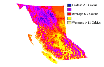
Mean April Maximum
Temperature
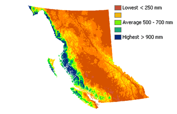
Mean September
Total Precipitation
The climate data used
to produce the above two maps was obtained from
Climate
Source
Key links to other biogeography maps
Rare
plant hotspots in BC--Map (Scudder 2003)
Vascular
Plant Richness in BC--Map (Scudder 2003)
Scudder, G. 2003. Biodiversity Conservation and Protected Areas in BC. Department of Zoology, UBC, Prepared for the Sierra Legal Defence Fund.
Recommended citation: Author, date, page title. In: Klinkenberg, Brian. (Editor) 2021. E-Flora BC: Electronic Atlas of the Flora of British Columbia [eflora.bc.ca]. Lab for Advanced Spatial Analysis, Department of Geography, University of British Columbia, Vancouver. [Date Accessed]
E-Flora BC: An initiative of the Spatial Data Lab, Department of Geography UBC, and the UBC Herbarium.
© Copyright 2021 E-Flora BC.