|
|||||||||||||||||||||||
 |
|||||||||||||||||||||||
|
The Sea to Sky Highway is a stretch of highway that runs along the steep-sided Howe Sound fjord from the western tip of the Trans-Canada Highway at Horseshoe Bay in Vancouver north beyond Whistler, British Columbia. It is home to many geomorphological, hydrological, climactic and biogeographical wonders from debris flows to snow storms. On this map you will find a few of the many interesting places that can be discovered along this scenic stretch of highway. Click here for full screen map.
Info
Photos
Additional Resources
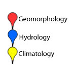
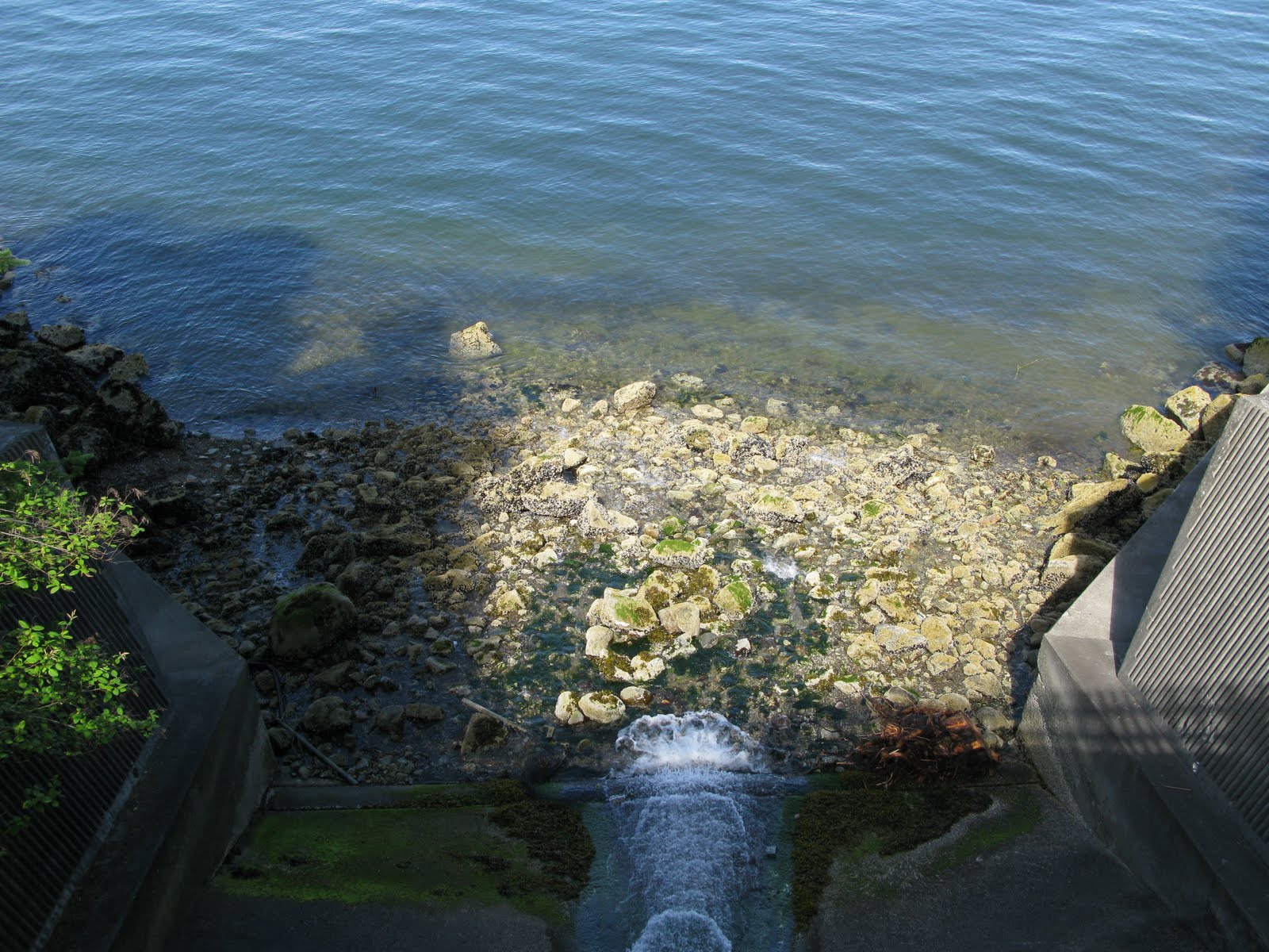
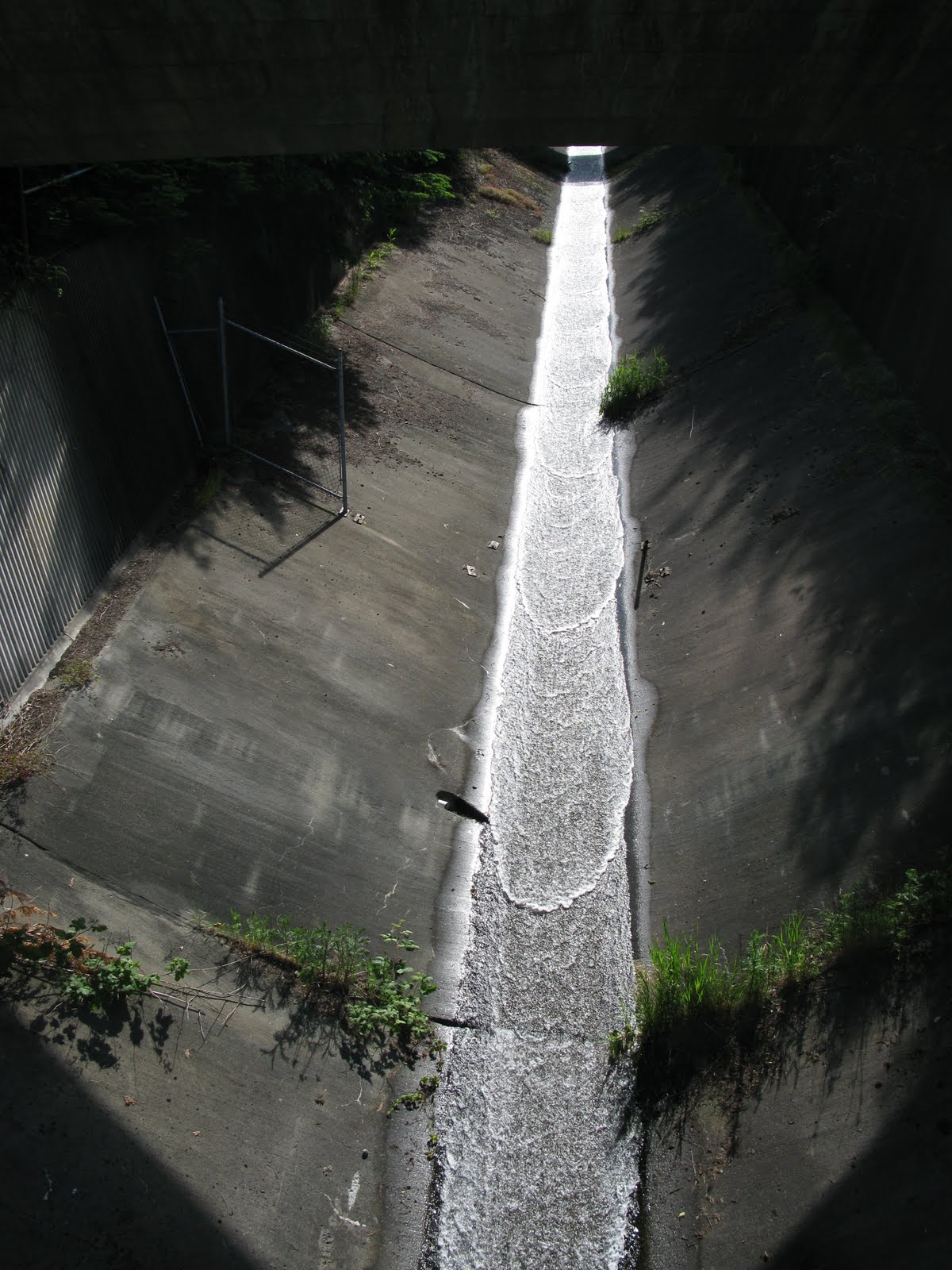
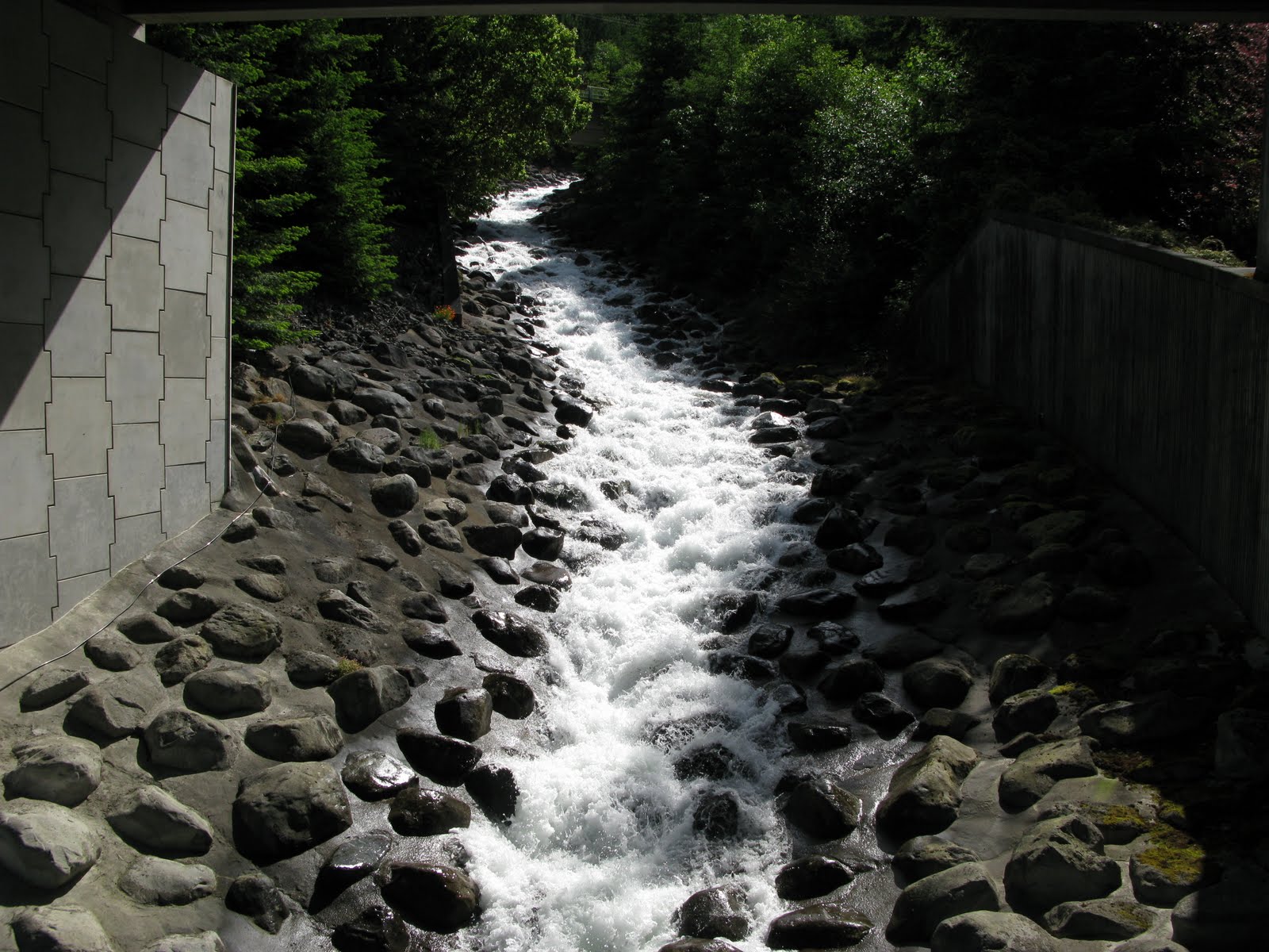
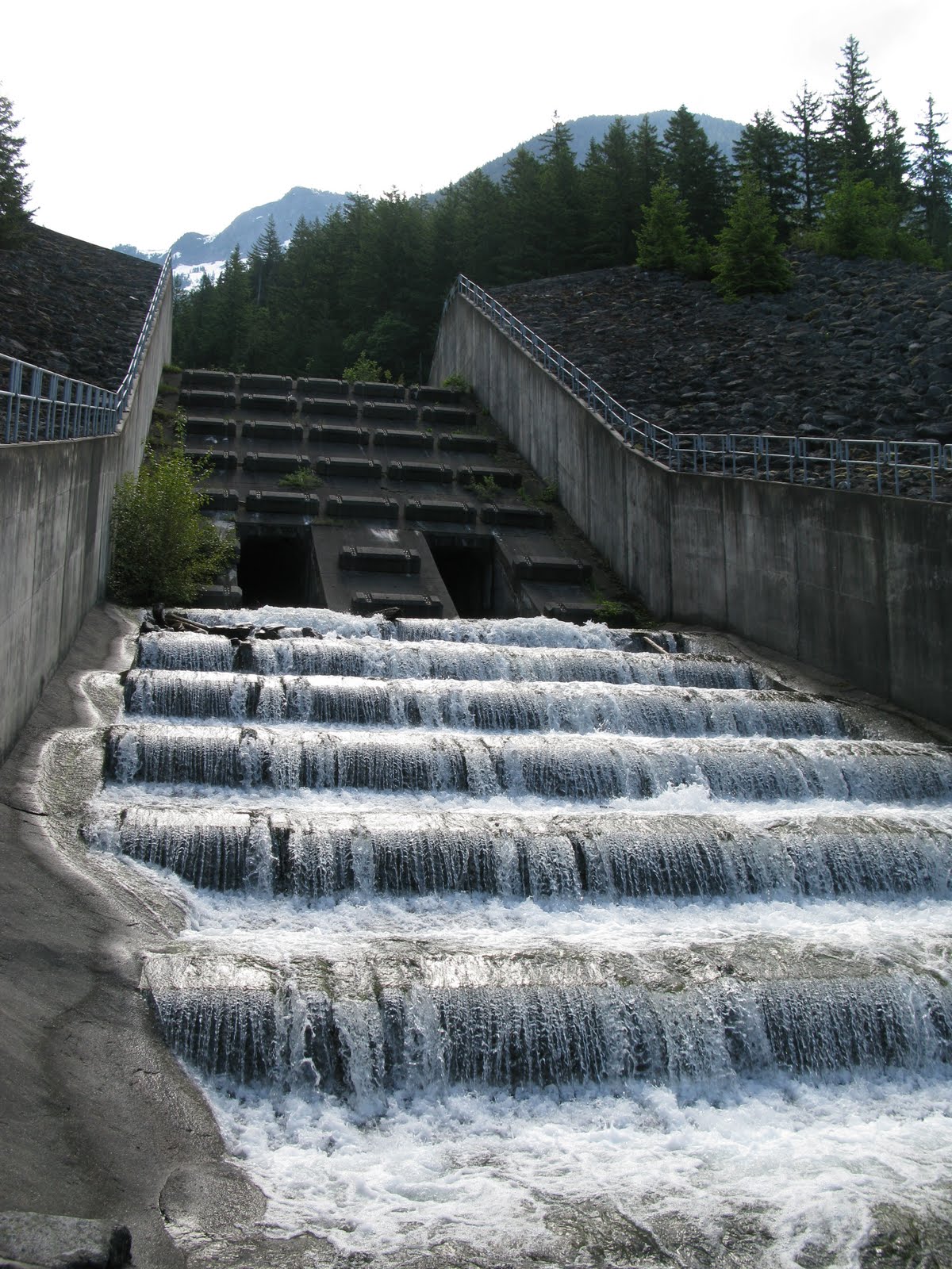
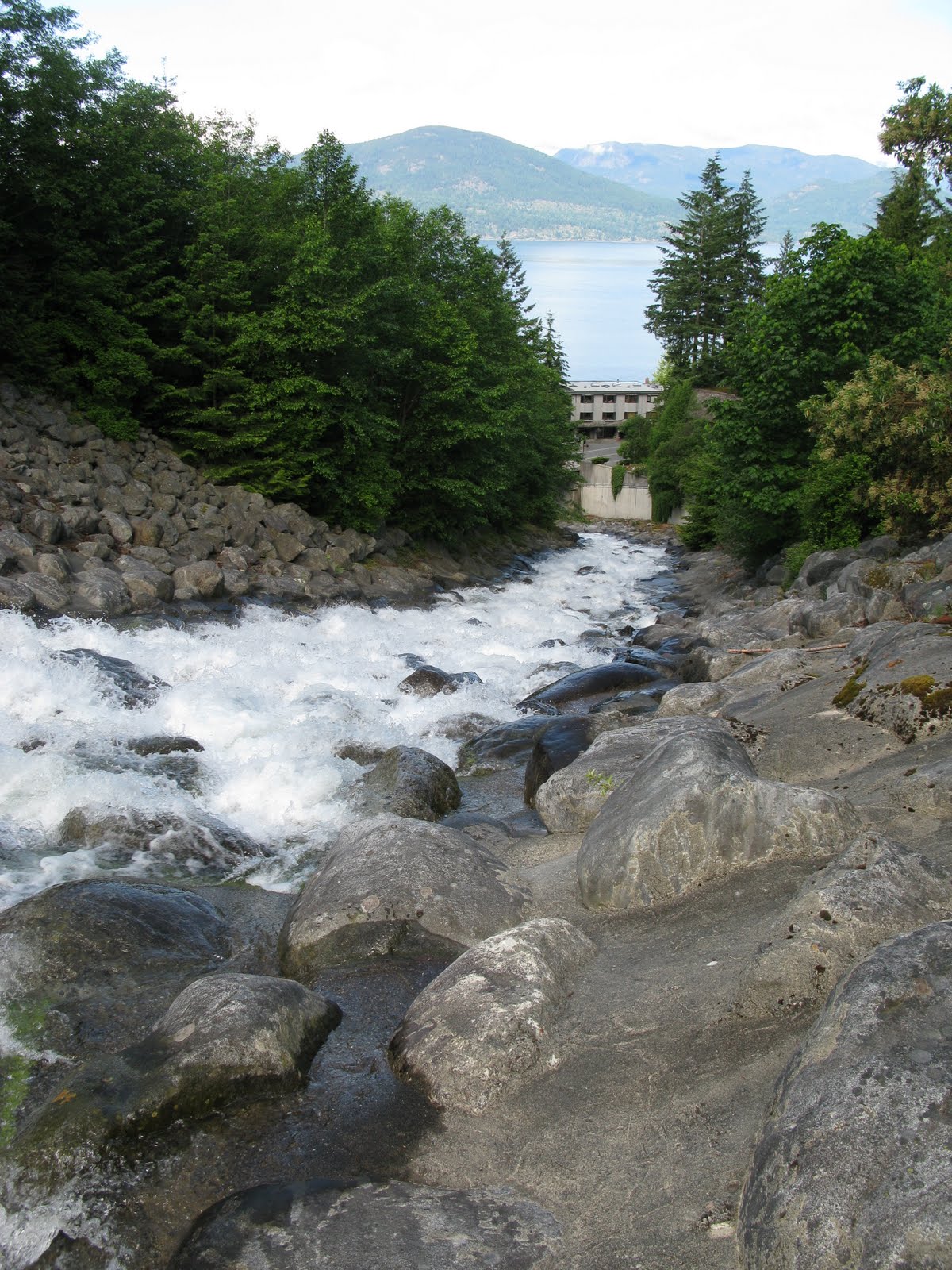
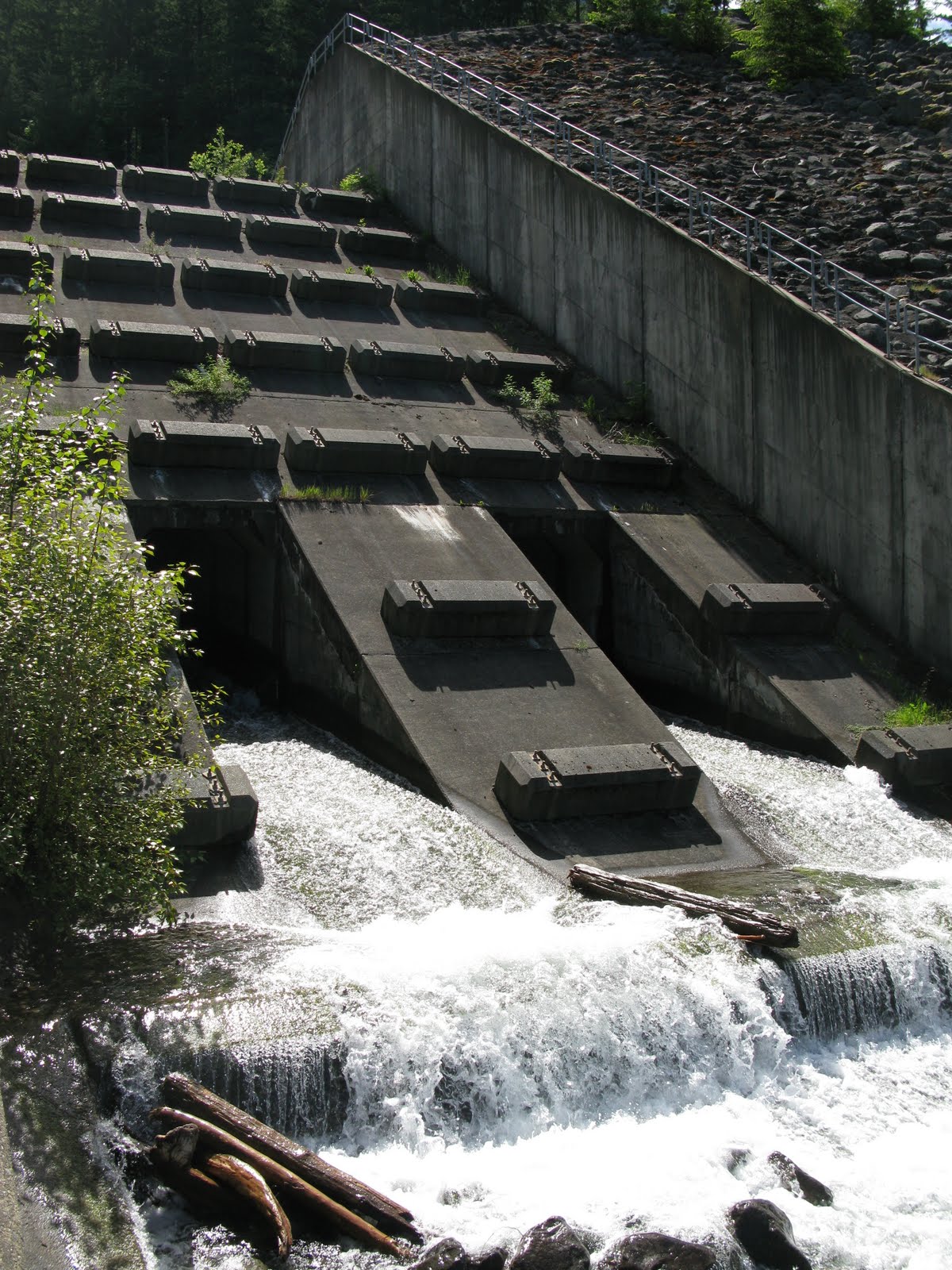
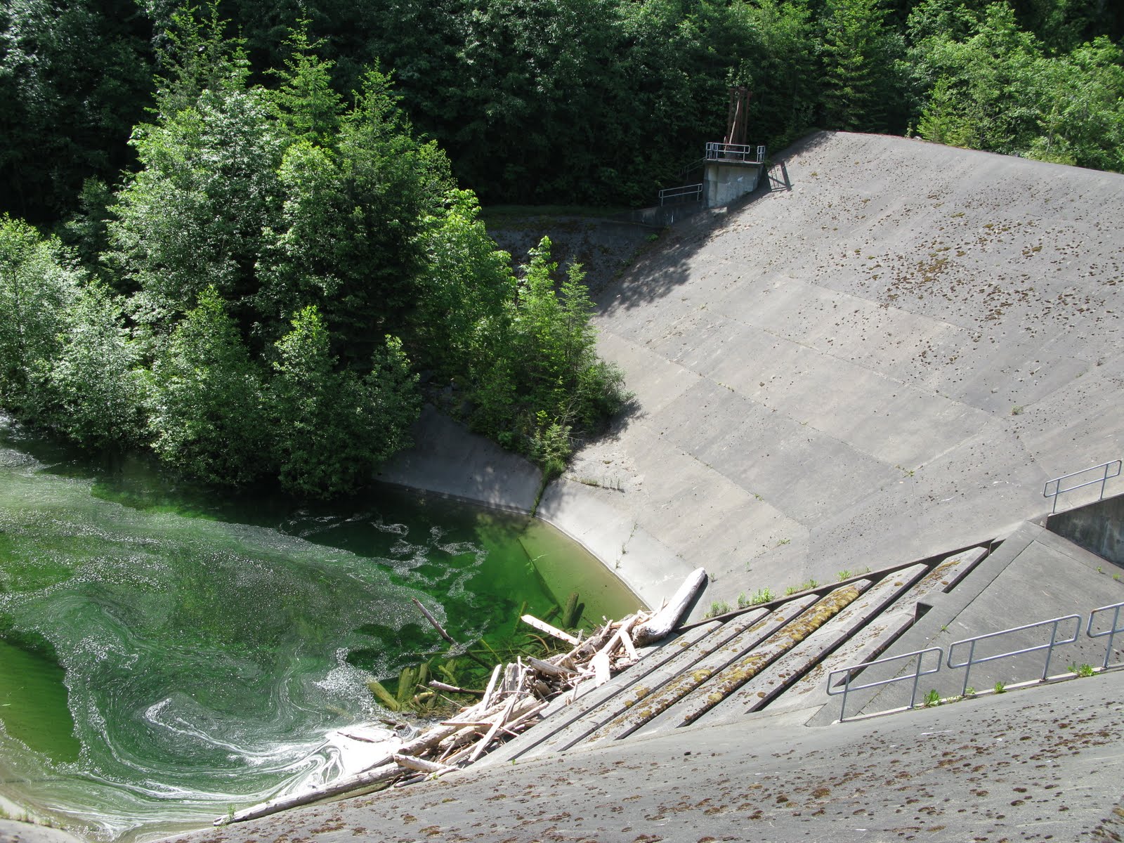
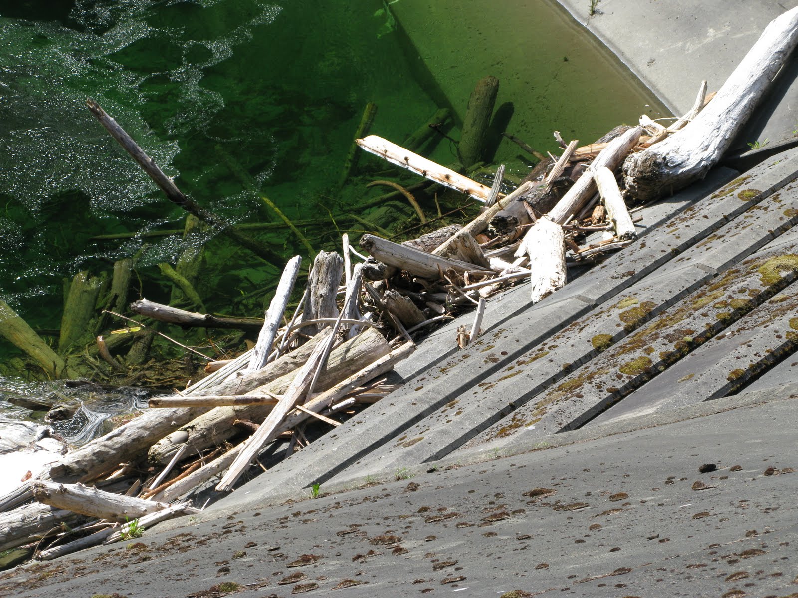
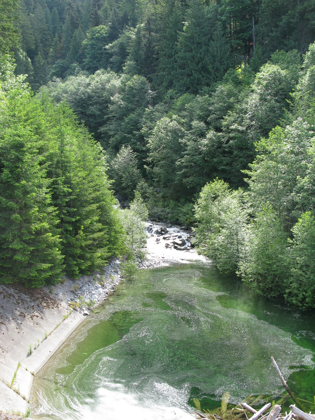
Lions Bay
At Lions Bay, British Columbia there is a large debris flow dam. Because of the steep slopes of the Howe Sound Fjord coupled with high human activity, there is a high risk for debris flows to occur, which can be dangerous and potentially fatal. In 1983 there was a large debris flow on Alberta Creek in Lions Bay, taking out multiple houses and with a few people losing their lives. In response, they built a large debris flow dam and containment structure, including a concrete flume that carries the stream and sediment directly into the sound.
Click photo for high resolution image
Further Reading
Evans, S.G. & Savigny, K.W.(1994). Landslides in the Vancouver-Fraser Valley-Whistler region. Geological Survey of Canada, Bulletin 481. p. 251-286.
Info
Photos
Additional Resources
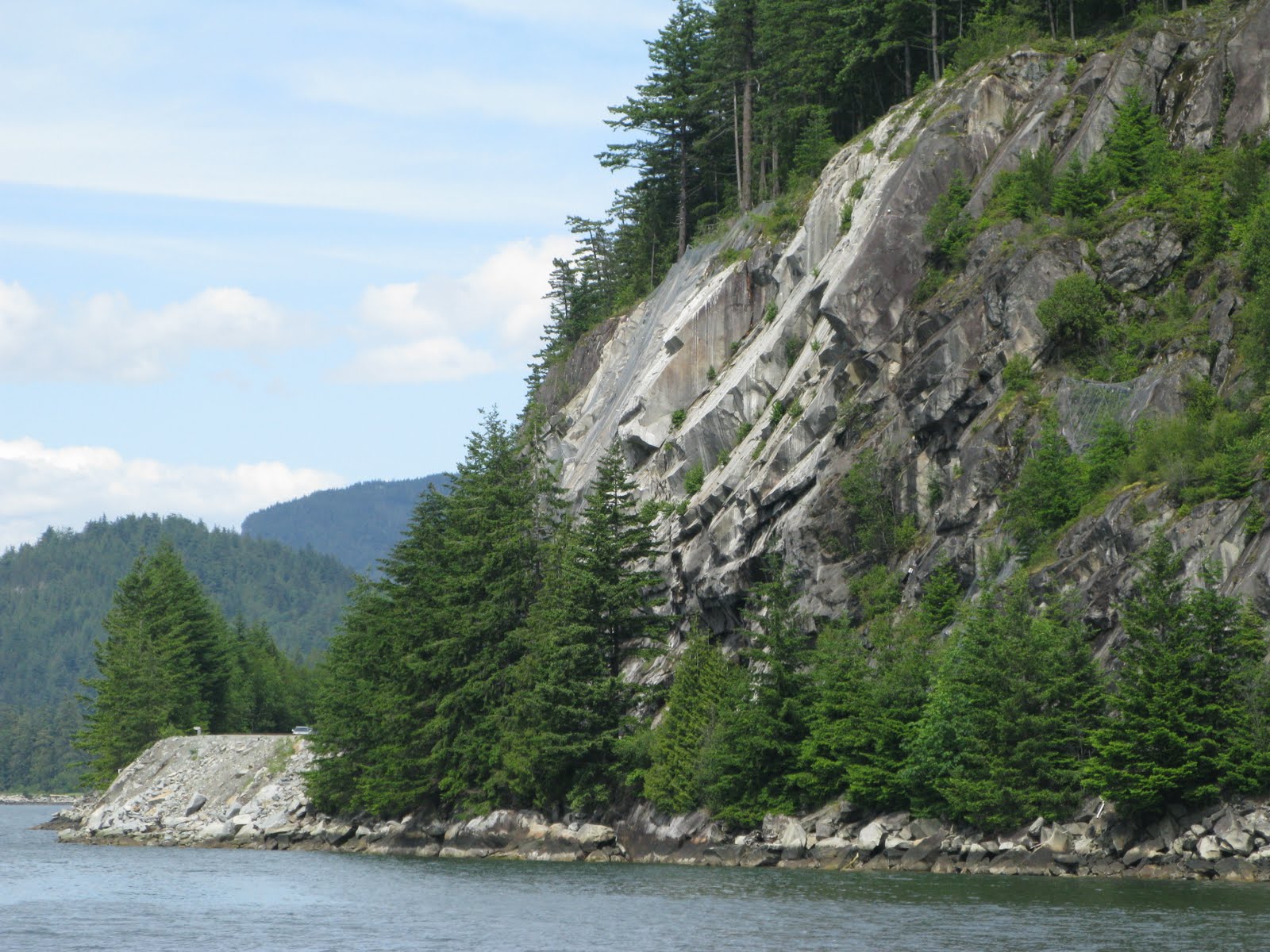
Porteau Bluff
The steep sides of the Howe Sound are subject to massive failures that can cripple the Sea to Sky highway infrastructure. On July 29th, 2008, a shear of rock near Porteau Cove failed, barely missing a bus full of passengers. Luckily no one was hurt, but this is an example of the dangers of the steep rocky cliffs along the highway. Click photo for high resolution image.
Info
Photos
Additional Resources
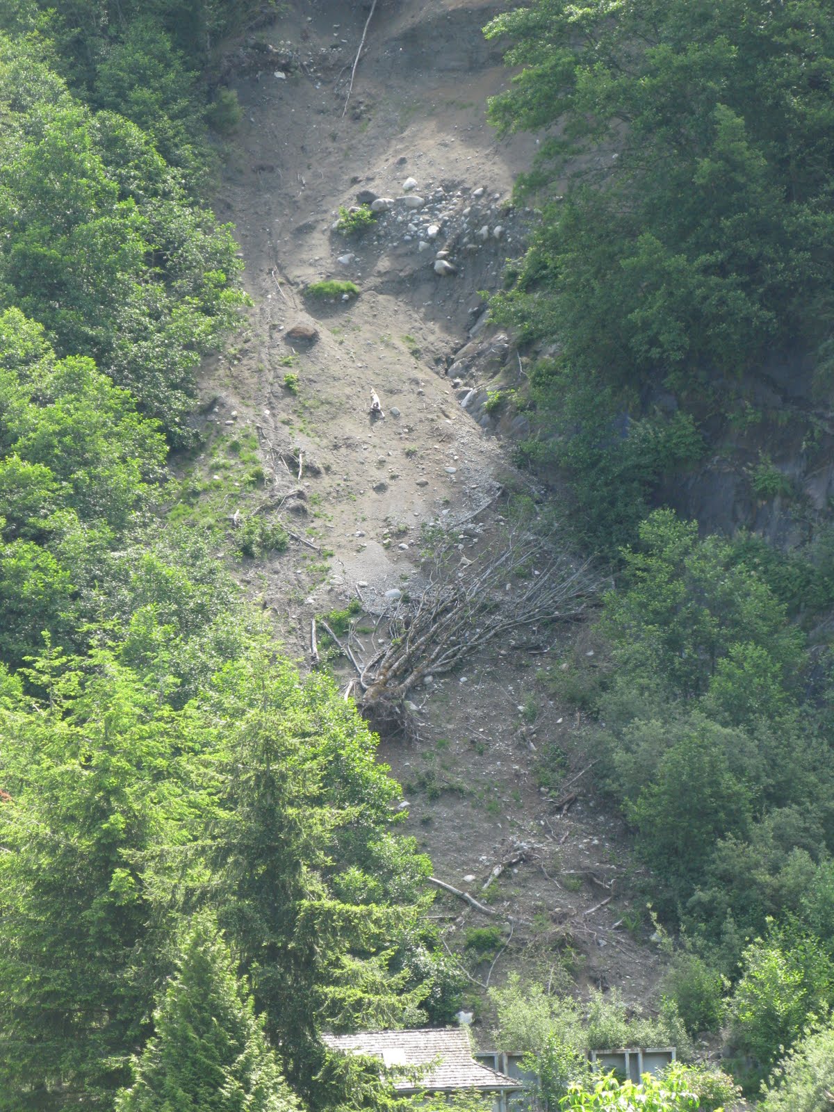
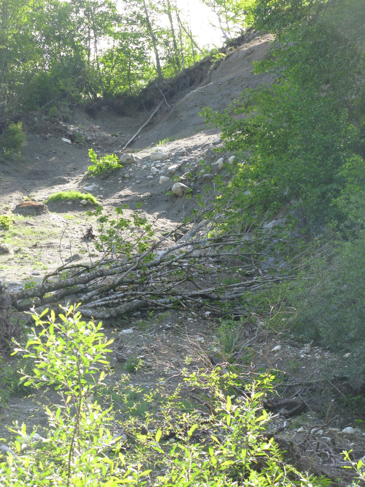
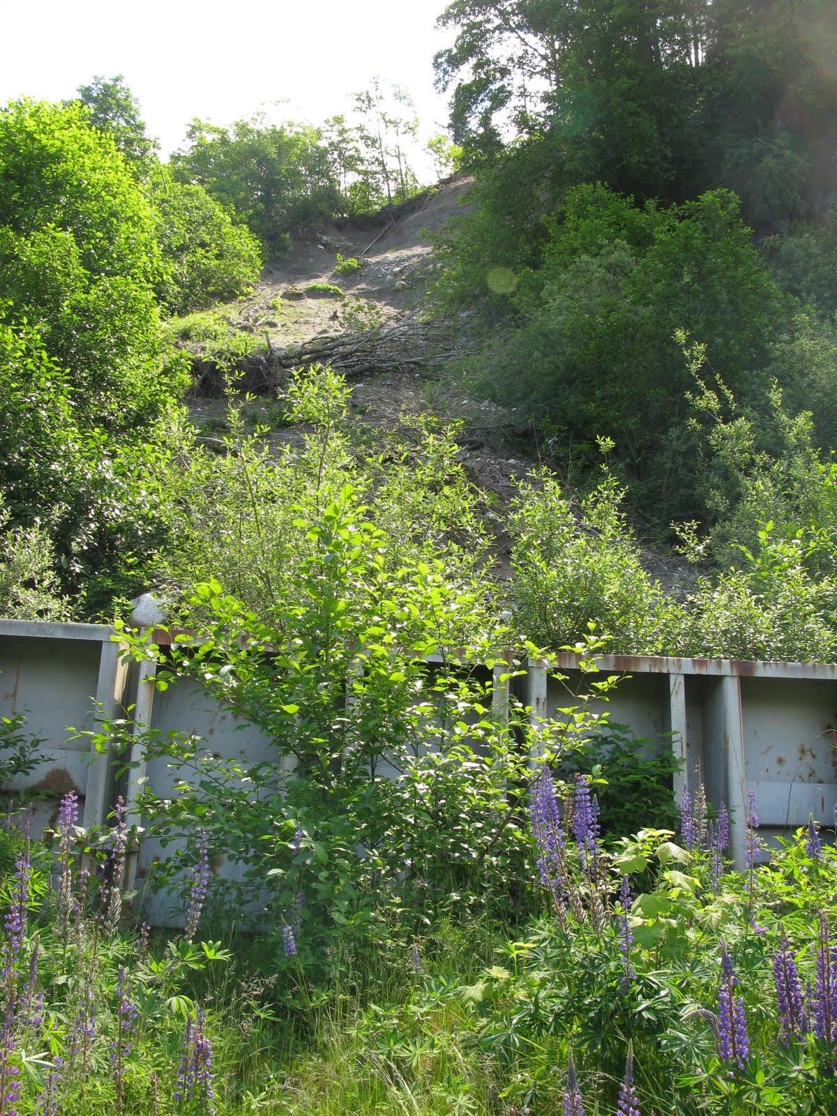
Furry Creek Golf Course Landslide
There has been a small landslide on a hill on the Furry Creek Golf Course. There is a small landslide retainment structure at the bottom of the slope and a golf maintenance building just next to the bottom of the slide. Access is off-limits to non-golfers. Click photo for high resolution image.
Not Available
Info
Photos
Additional Resources
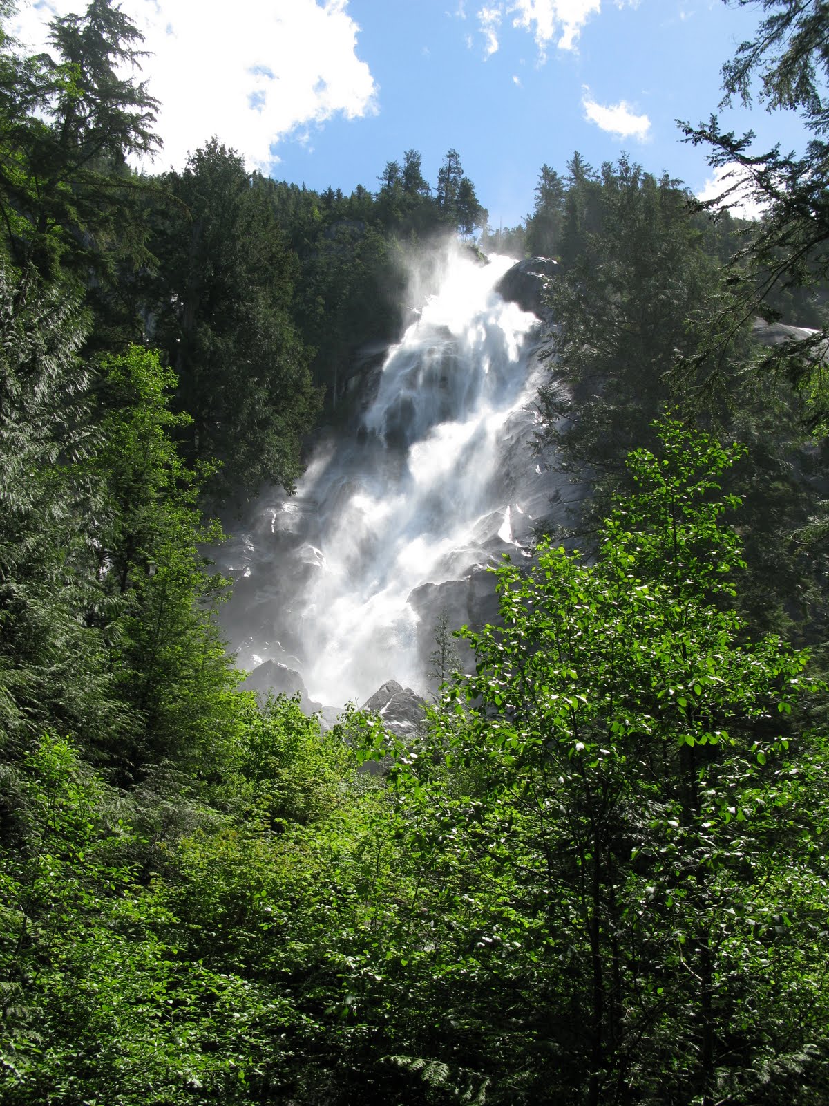
Shannon Falls
A bedrock waterfall over 300 meters tall. Easy access off the highway with parking and a beautiful place to have lunch and enjoy the waterfall. Click photo for high resolution image.
Info
Photos
Additional Resources
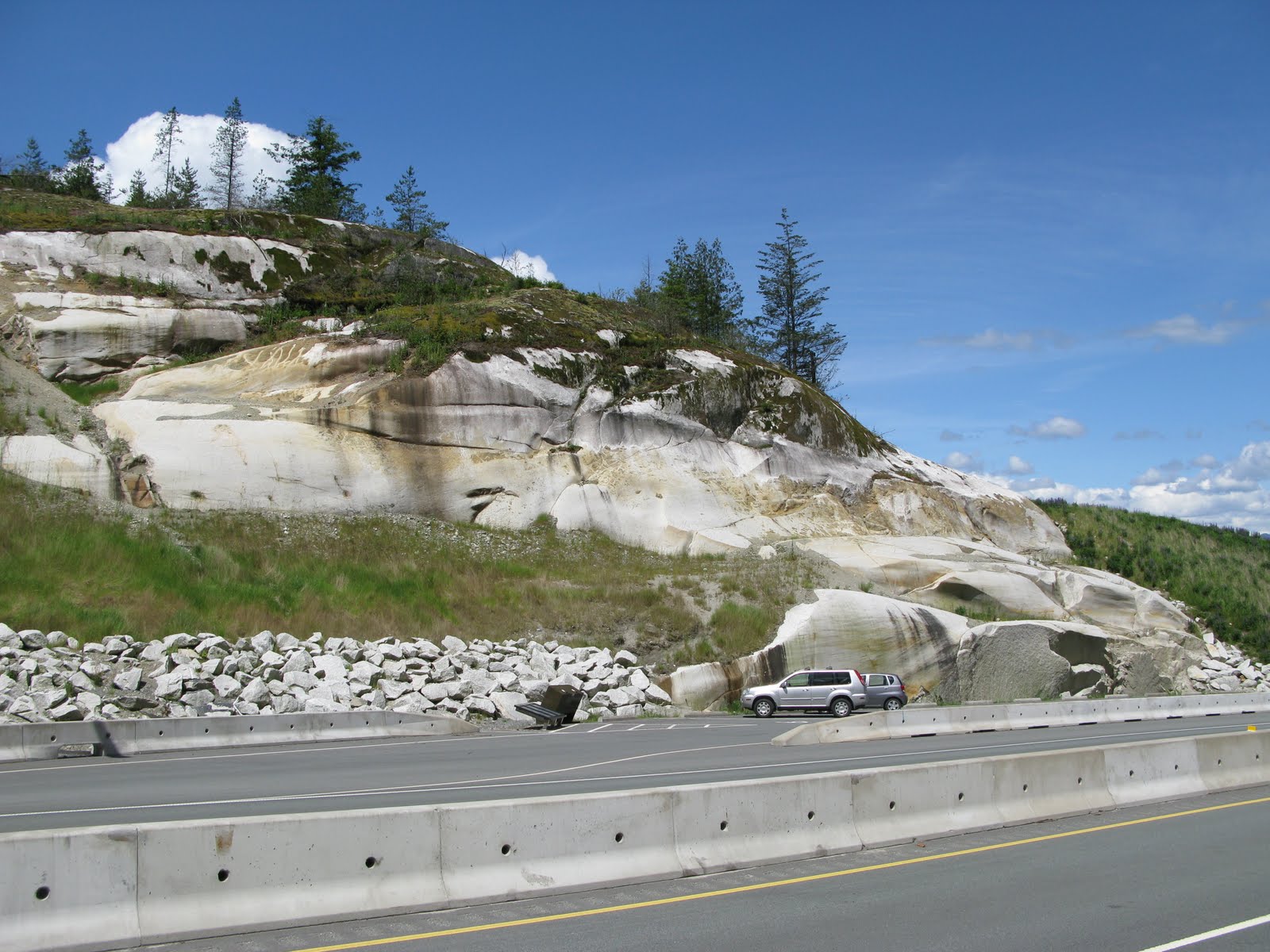
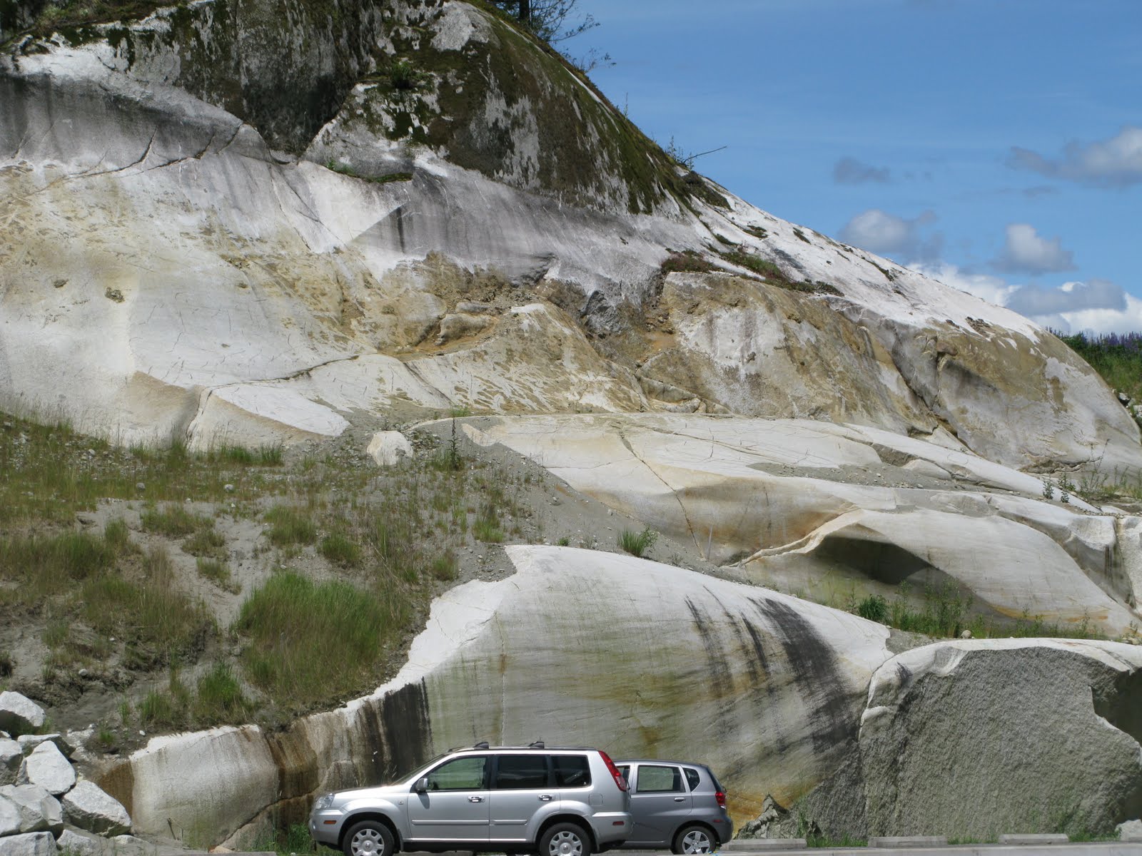
Glacial Polish
This outcrop of rock was polished by the immense glaciers during the last glaciation of the region around 15000 years ago. Click photo for high resolution image.
Not Available
Info
Photos
Additional Resources
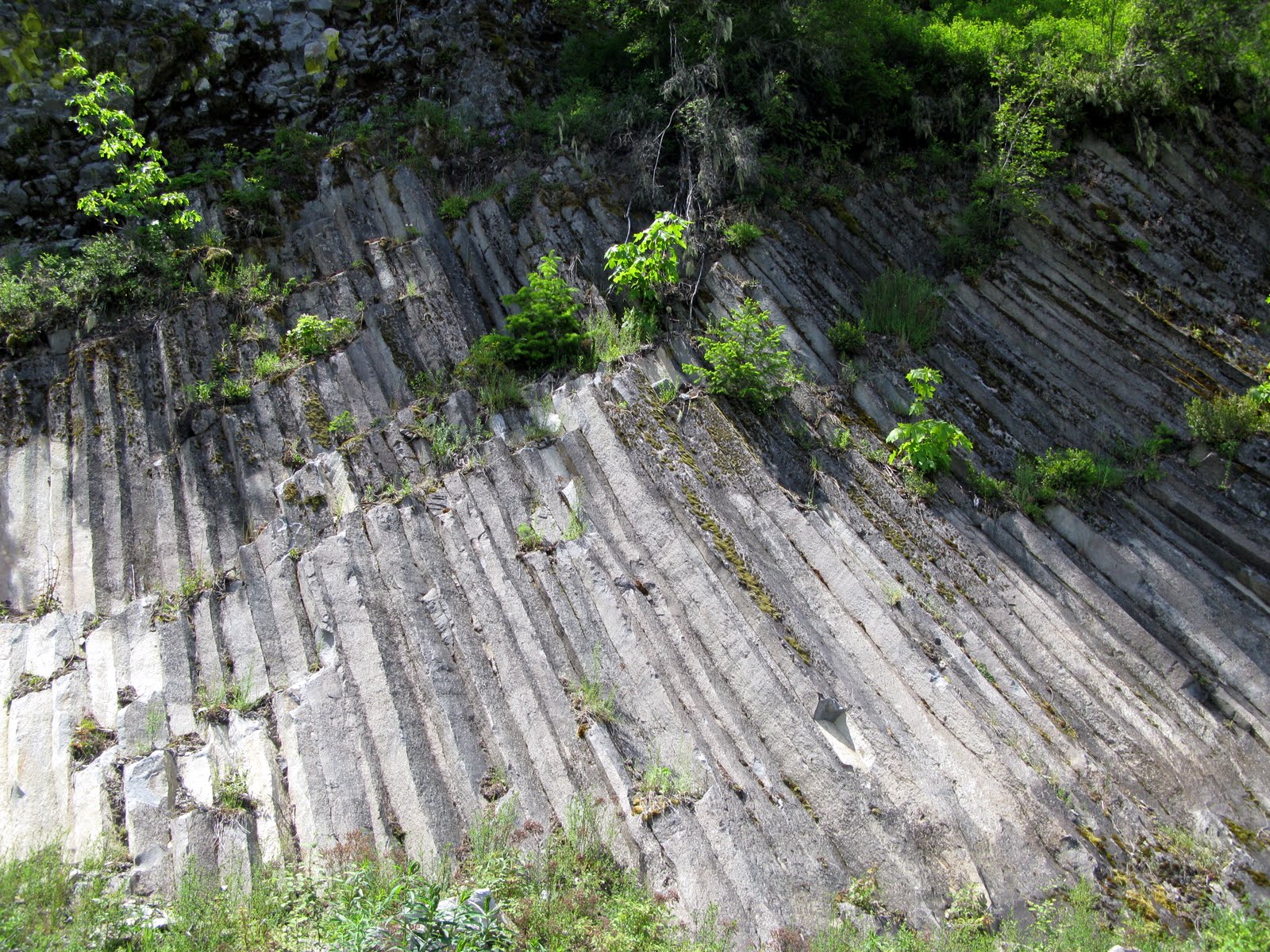
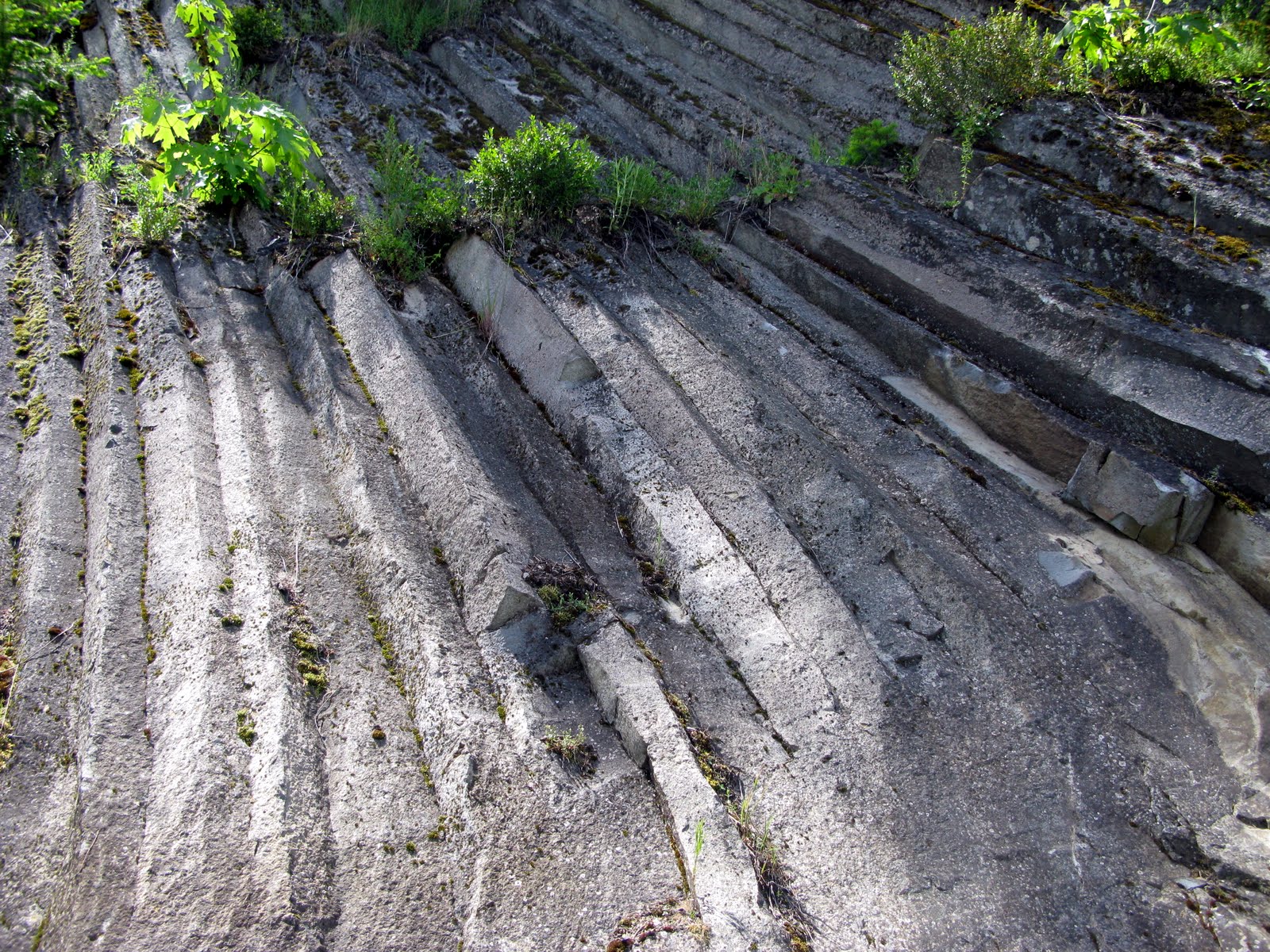
Columnar Basalt
Up a quarry road is a good example of columnar basalt. Many have toppled to the slope below, but there is still a clear example of basaltic columns on the side of the hill. Click photo for high resolution image.
Not Available
Info
Photos
Additional Resources
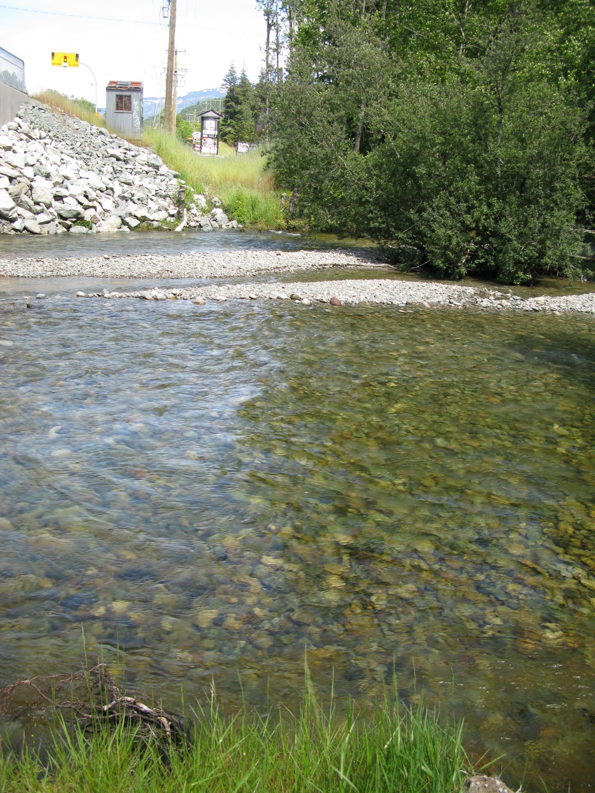
08GA076 STAWAMUS RIVER AT HIGHWAY NO. 99
Drainage Area 52 Click photo for high resolution image.
CSV Hydrometric Data
Spreadsheet of Daily Data
Info
Photos
Additional Resources
08GA048 MAMQUAM RIVER NEAR SQUAMISH
Drainage Area 378 Not Available
CSV Hydrometric Data
Spreadsheet of Daily Data
Information
Photos
Additional Resources
08GA022 SQUAMISH RIVER NEAR BRACKENDAL
Drainage Area 2330 Not Available
CSV Hydrometric Data
Spreadsheet of Daily Data
Info
Photos
Additional Resources
Britannia Beach/Furry Creek Climate Station
Latitude: 49°35'02" N Not Available
Historical Data
Spreadsheet of Monthly Data
Info
Photos
Additional Resources
Squamish Climate Station
Latitude: 49°42' N Not Available
Historical Data
Spreadsheet of Monthly Data |
|||||||||||||||||||||||
|
Department of Geography - Faculty of Arts - The University of British Columbia |
|||||||||||||||||||||||