|
|||||||||||||
 |
|||||||||||||
|
Malcom Knapp Research Forest Located in the foothills of the Coast Mountains, ~60 km east of Vancouver, the forest contains just about every type of terrain found in southern coastal BC. The forest stretches north and east up the slopes of the Golden Ears Mountains to ~1000 m above sea level, west down to sea level at Pitt Lake, and south to the edge of the urban interface in Maple Ridge. Please note - the MKRF is not open to the public, so this field trip cannot be conducted by those outside of guided groups.
Click here for full screen map.
Information
Photos
Additional Resources
Site 1: Bridge over the Allouette on 'A' road
Excellent example of bed rock controlled channel. Trail down to river edge on the left hand side of the road. Parking space for ~2 vehicles Not suitable for gauging. Would be very dangerous in high flows. Not Available Not Available
Information
Photos
Additional Resources
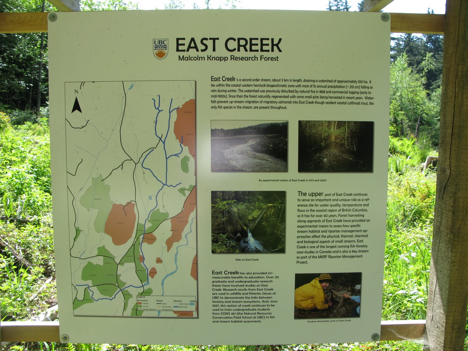
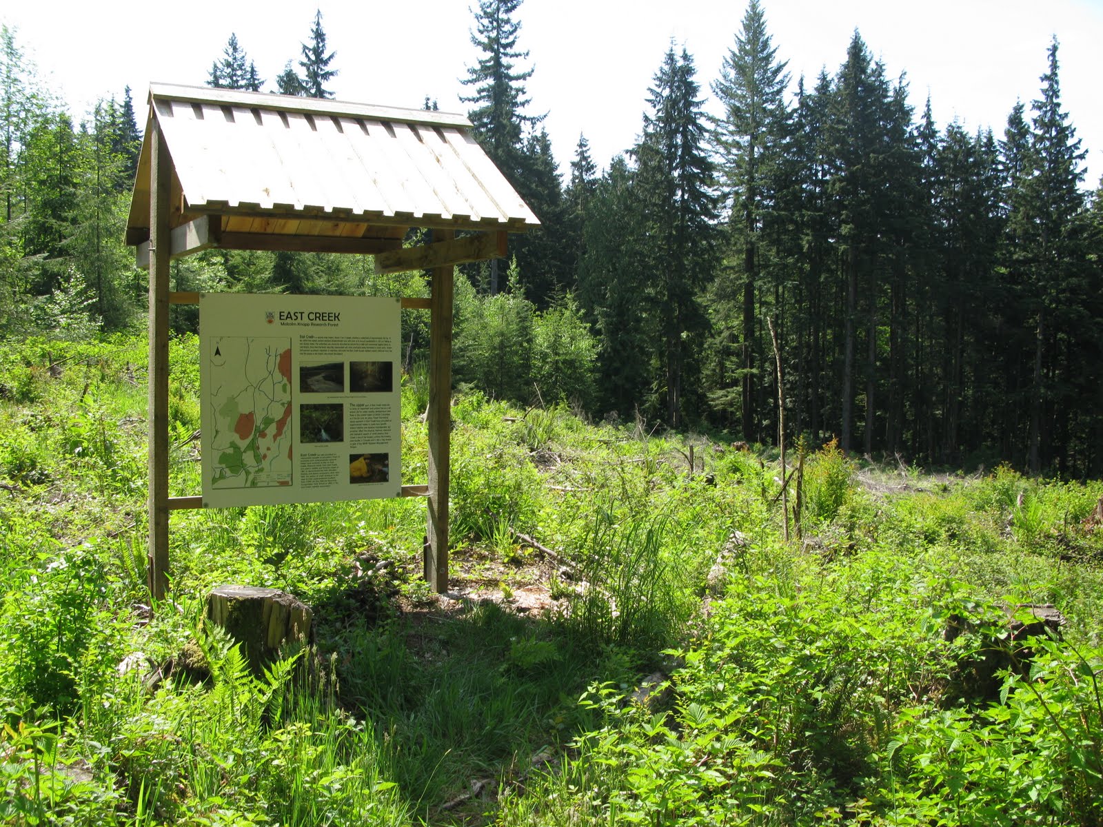
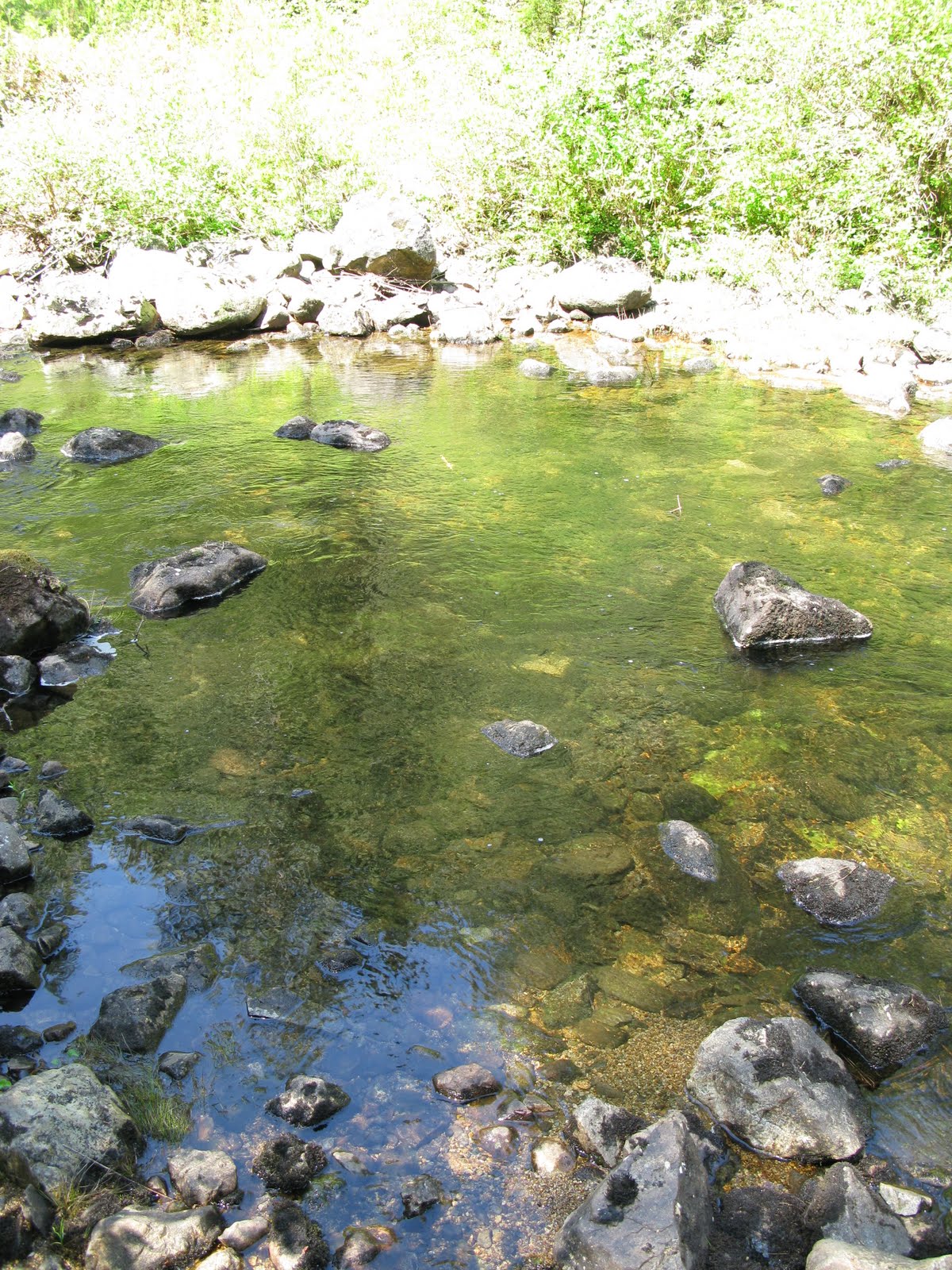
Site 2: East Creek Sign
Little blurb about the history of East Creek and the research that is being conducted there. Good example of the effects of logging on a creek as there is a clear cut right to the edge of the creek on one side of the road and the other side has mature second growth. Lots of sunlight on logged part and algae growth.
Click photo for high resolution image
Not Available
Information
Photos
Additional Resources
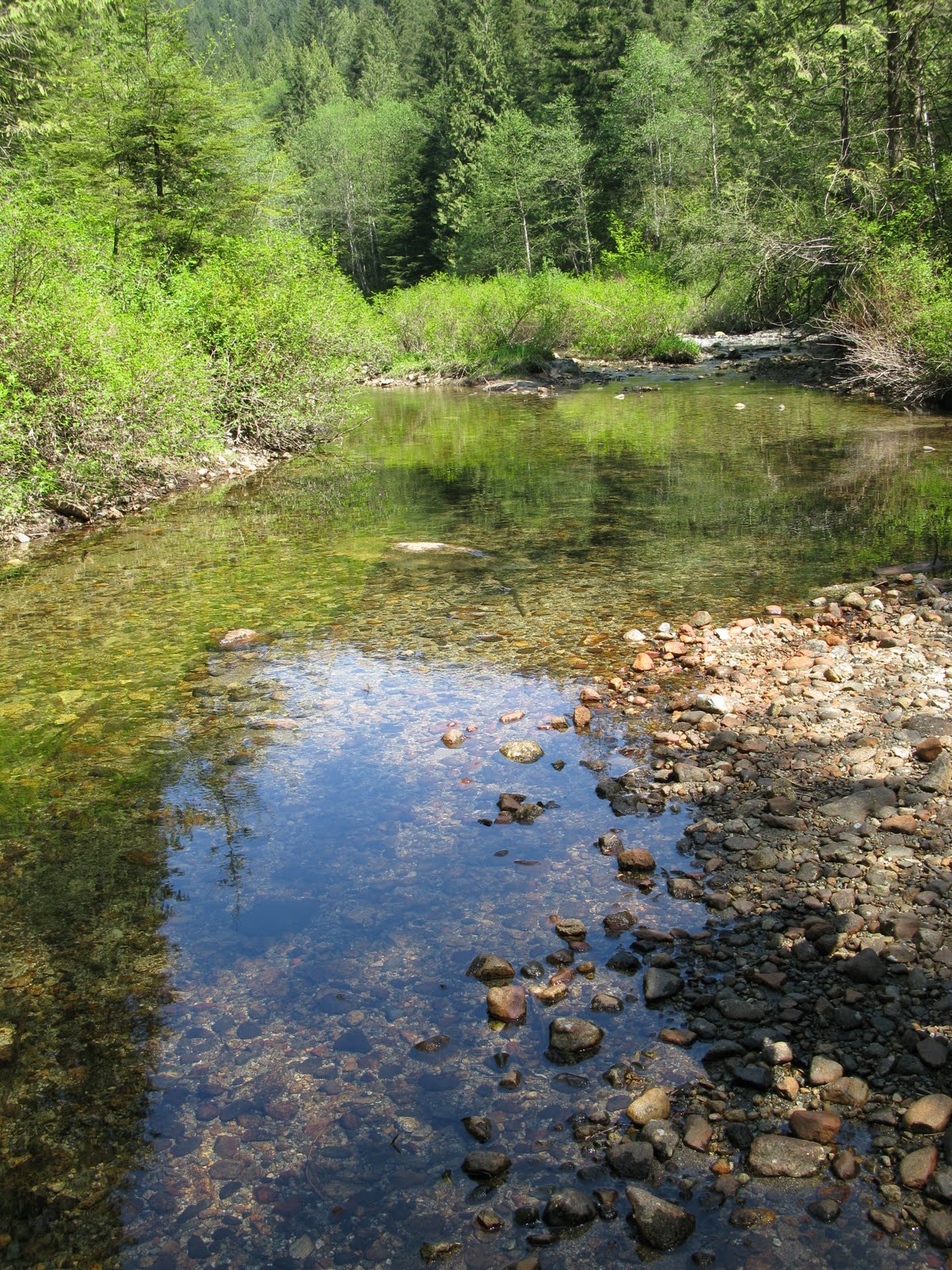
Site three: Crossing of Alouette on K road
Open, wide (~10m) channel. Partially bedrock controlled. Good cross section for gauging. In the flow conditions we saw, it could have been crossed in just rubber boots. Easy access to the river. Large parking area for many cars. Shortly down stream of Marion Lake so very few fines present. Channel appears starved of sediment.
Click photo for high resolution image
The stream bed Not Available
Information
Photos
Additional Resources
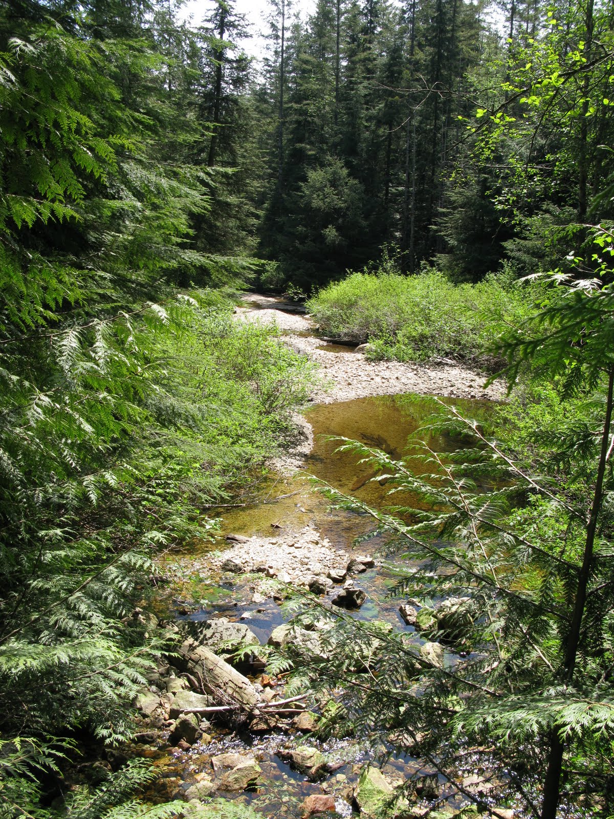
Site Four: Confluence of Mayfly and Alouette. Site of Jon Richards experimental channels.
Good site for bulk samples on the Alouette. Could also be used for gauging. Would be possible in rubber boots. The Mayfly is considerable steeper and is depositing much coarser material in a small fan as it reaches the Alouette. Very rapid change in grain size. Trail from study site to creek a bit bushy.
Click photo for high resolution image
Shallow streambed with gravel bars Not Available
Information
Photos
Additional Resources
Site Five: Access to Mayfly off of 'B' Road
Creek is clogged with log jam (all cut timbers - man made?). Large accumulation of fines up stream. Not very interesting. Old abandonded artifical channel site of same design as the one lower down. Not Available Not Available
Information
Photos
Additional Resources
Site Six: Crossing of unknown creek on 'E' road.
Very high sediment supply with large midchannel bars. The creek is about 5m wide and crossable in gum boots. Not suitable for gauging.
Click photo for high resolution image
Stream viewed from the road Not Available
Information
Photos
Additional Resources
Site seven: Unknown creek off of E10
E10 is very rough, requires HC 4x4 Can hike up from main road ~5-10 mins Still large supply of sediment, partially bedrock controlled There is a study here by Kim ? on trout. Not Available Not Available
Information
Photos
Additional Resources
Site Eight: Cut into glacial-marine sediment
Mostly covered in sluff. There are two exposures, one in a pit just off the highway and another up a small road ~15m long. 0.5 to 1 meter of exposure and could probably see more if you had a shovel.
Click photo for high resolution image
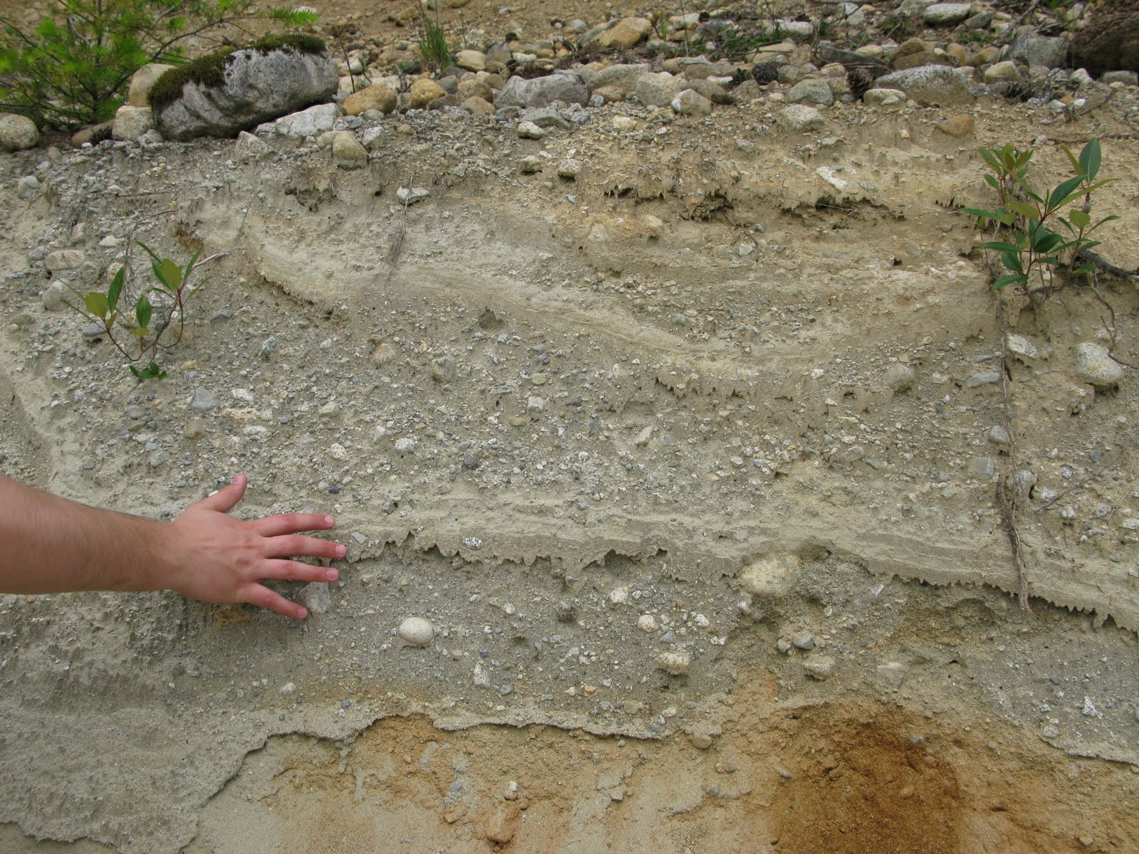 The cut of glacial-marine sediment Not Available
Information
Photos
Additional Resources
Site Nine
Just down the road you cross a bridge over a small (~5-8m wide) creek with step pool morphology. Good access on the right bank down old road. There is an old shed with large water intake. Not Available Not Available
Information
Photos
Additional Resources
Site Ten: Unknown creek crossing 'G' road
Small channel (~2-3m wide), step pool morphology and incised into slope. No good access. Not Available Not Available
Information
Photos
Additional Resources
08MH005 ALOUETTE RIVER NEAR HANEY
Drainage Area 234 Not Available
CSV Hydrometric Data
Spreadsheet of Daily Data
Information
Photos
Additional Resources
08MH006 NORTH ALOUETTE RIVER AT 232ND STREET, MAPLE RIDGE
Drainage Area 37.3 Not Available
CSV Hydrometric Data
Spreadsheet of Daily Data
Information
Photos
Additional Resources
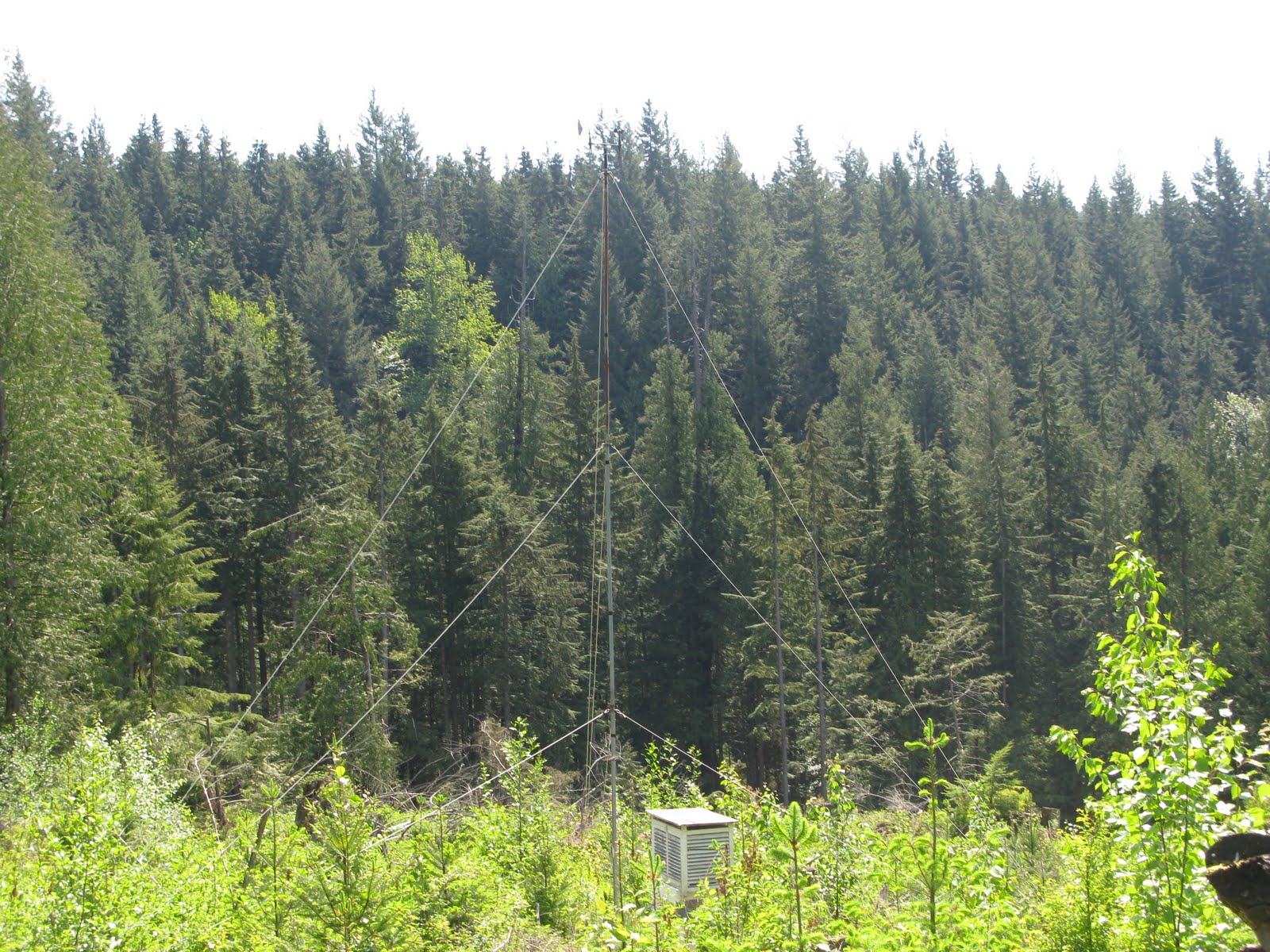
Pitt Meadows Climate Station
Latitude: 49°12'29.900" N
Click photo for high resolution image
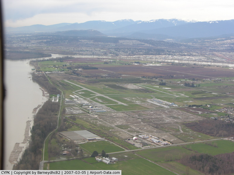 View of the airport where the station is located
Historical Data
Spreadsheet of Monthly Data
Information
Photos
Additional Resources
Haney UBC RF Admin Climate Station
Latitude: 49°15'54.000" N Not Available
Historical Data
Spreadsheet of Monthly Data
Information
Photos
Additional Resources
Haney UBC RF Admin Climate Station
Not Available
Historical Data
Spreadsheet of Monthly Data Click here to get directions to the forest from the Geography Department |
|||||||||||||
|
Department of Geography - Faculty of Arts - The University of British Columbia |
|||||||||||||