Grassland Flux Tower / Rural Reference Site
Westham-Island

by Andreas Christen(1) and Tim Oke(1)
and in collaboration with Sue Grimmond(2), and James Voogt(3).
(1) University of British Columbia, Department of Geography, Vancouver, BC, Canada.
(2) University of Reading, Department of Meteorology, Reading, UK.
(3) University of Western Ontario, Department of Geography, London, ON, Canada.
 In the CFCAS network 'EPiCC - Environmental Prediction in Canadian Cities', this climate and flux-tower served as a rural reference site. It was used in combination with the urban flux towers Vancouver-Sunset and Vancouver Oakridge to quantify urban climate modifications year-round. The instrumentation at this site was continuously operated between July 2007 and October 2009. In the CFCAS network 'EPiCC - Environmental Prediction in Canadian Cities', this climate and flux-tower served as a rural reference site. It was used in combination with the urban flux towers Vancouver-Sunset and Vancouver Oakridge to quantify urban climate modifications year-round. The instrumentation at this site was continuously operated between July 2007 and October 2009.
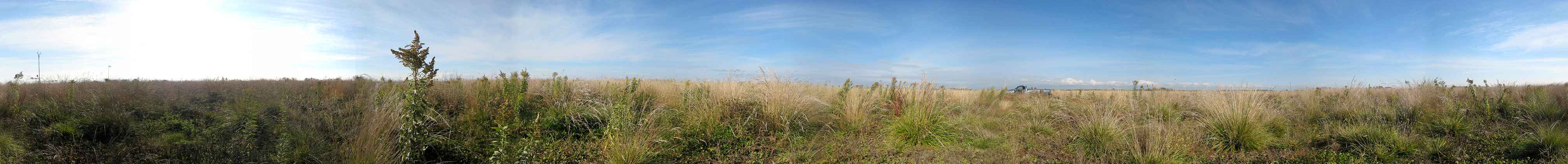
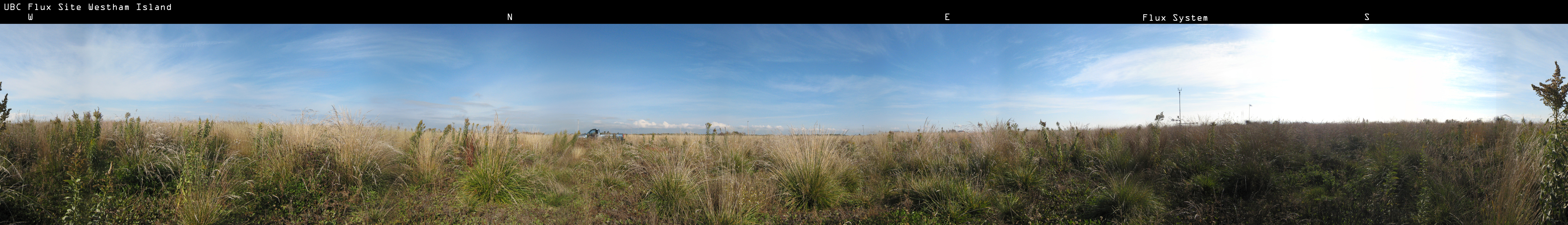
Interactive panorama at the site in Fall 2008, also available in high-resolution for download with labels. Click on image and drag mouse to pan, use ↑ and ↓ keys to zoom in and out.
The rural site ‘Westham Island’ is located on flat, unmanaged and non-irrigated grassland, 16 km to the south of the urban site in a remote area that is dominated by intensive farming (49.086°N. 123.177°W, WGS-84, 2 m a.s.l.). The site is characterized as Local Climate Zone 11 'low plant cover'. Instruments used in this study to measure radiative and turbulent fluxes were sited on a tripod system (CM-115, Campbell Scientific Inc., Logan, UT, USA), 1.5 and 1.8 m above the local ground surface. The site was colonized by a diverse set of tall grasses that ranged in average stand height between 0.5 m (winter) and a maximum of 175 m (August 2009). Heights of most instruments were adjusted in summer to account for the growing grass height.
|
Selected publications on Westham Island:
Technical reports
|
|
|
|
|