
Red-flagged Species
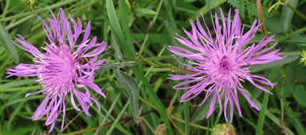
Brown Knapweed (Centaurea jacea), photo by Robert
Flogaus-Faust.
Some distribution maps on E-Flora BC are red-flagged because they do not correspond to the currently known distribution of a taxon in BC based on recent re-assessments of a species by BC Conservation Data Centre (BCCDC) botanists and other botanists. There may be several reasons for this. There is often a lag tme between re-assessment and incorporation of that information into the databases we use for mapping. This can result in a species appearing more wide-spread or more restricted in distribution than is actually the case. In these cases, we recommend checking with the BC Species and Ecosystem Explorer for current distribution information for red- and blue-listed species or directly checking the specimens to view re-annotations and ID changes. At some point, the databases will be adjusted to incorporate changes, and our maps will reflect this.
Additionally, distribution dots based on observation-only data (and not specimen-based data) may be unreliable. This applies in particular to the IAPP and BEC data layers. If you are assessing a species distribution in BC, we recomment that you turn off trhese data layers on the distribution maps. Only 10% of records from the BEC database are supported by voucher specimens, and the remainder of the records cannot be verified. IAPP records may have no voucher specimens.
Recommended citation: Author, date, page title. In: Klinkenberg, Brian. (Editor) 2021. E-Flora BC: Electronic Atlas of the Flora of British Columbia [eflora.bc.ca]. Lab for Advanced Spatial Analysis, Department of Geography, University of British Columbia, Vancouver. [Date Accessed]
E-Flora BC: An initiative of the Spatial Data Lab, Department of Geography UBC, and the UBC Herbarium.
© Copyright 2021 E-Flora BC.